Live Updates

The latest on Hurricane Beryl

CNN " data-fave-thumbnails="{"big": { "uri": "https://media.cnn.com/api/v1/images/stellar/prod/still-20761854-7030320-482-still.jpg?c=16x9&q=h_540,w_960,c_fill" }, "small": { "uri": "https://media.cnn.com/api/v1/images/stellar/prod/still-20761854-7030320-482-still.jpg?c=16x9&q=h_540,w_960,c_fill" } }" data-vr-video="false" data-show-html="" data-byline-html="
By Elisa Raffa, CNN
" data-check-event-based-preview="" data-is-vertical-video-embed="false" data-network-id="" data-publish-date="2024-07-04T13:56:29.106Z" data-video-section="weather" data-canonical-url="https://www.cnn.com/2024/07/04/weather/video/hurricane-beryl-path-mexico-raffa-cnc-ldn-digvid" data-branding-key="" data-video-slug="hurricane-beryl-path-mexico-raffa-cnc-ldn-digvid" data-first-publish-slug="hurricane-beryl-path-mexico-raffa-cnc-ldn-digvid" data-video-tags="" data-details="">
still_20761854_7030320.482_still.jpg
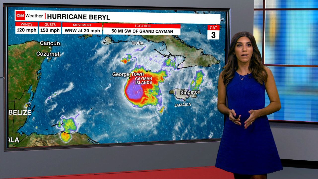
See where Hurricane Beryl is heading next after landfall in Jamaica
01:36 - Source: CNN

What we're covering

  • Hurricane Beryl is now a strong Category 2 storm as it heads toward Mexico after hammering several Caribbean islands. The storm has killed at least nine people. Stay updated on its path here.
  • Beryl will unload damaging winds, torrential rainfall and dangerous storm surge over a significant portion of Mexico’s Yucatan Peninsula, a tourist area, as it makes landfall this morning. The storm will then emerge in the Gulf of Mexico and impact parts of northeastern Mexico and South Texas this weekend.
  • Beryl was previously the earliest Category 5 storm on record in the Atlantic. It was also the strongest storm to impact Jamaica in over 15 years.
  • The abnormally warm ocean waters that facilitated Beryl’s intensification show that this hurricane season will be far from normal due to global warming caused by fossil fuel pollution.
  • If you are in an area of low connectivity, get the latest CNN updates here.
10 Posts

Beryl weakens slightly to strong Category 2 hurricane

Hurricane Beryl has weakened slightly to a strong Category 2 hurricane with sustained winds of 110 mph ahead of its landfall over Mexico’s Yucatan Peninsula, according to the latest update from the National Hurricane Center.

The storm is currently 40 miles (64 kilometers) east of the resort town of Tulum, and landfall is expected within the next couple of hours.

The updated track for Hurricane Beryl has it weakening to a tropical storm by Friday night before re-intensifying over the Gulf of Mexico with a potential landfall over southern Texas as a Category 1 hurricane early Monday.

How to help people impacted by Hurricane Beryl

Omar Soloman, left, and Keysha Hill gather what is left of his shop after it was destroyed when Hurricane Beryl passed through the area on July 4, in Old Harbor, Jamaica.

Hurricane Beryl, an early-season storm super-charged by abnormally warm ocean temperatures, ripped through the Caribbean and is charging towards Mexico.

Grenada’s Carriacou island was “flattened” when Beryl made landfall as a Category 4 storm, according to its prime minister.

Several charities are actively distributing aid throughout the region.

Contribute to relief efforts here.

What to know about this year's Atlantic hurricane season

Forecasters have predicted that 2024’s Atlantic hurricane season, which runs from June through the end of November, will be busier than usual.

In April, the Colorado State University Tropical Meteorology Project predicted an “extremely active” hurricane season, forecasting 23 named storms, including 11 hurricanes, five of them major.

In May, the Climate Prediction Center at the National Oceanic and Atmospheric Administration forecasted an 85% chance for an above-normal season. It predicted a 70% chance of having 17 to 25 named storms, of which eight to 13 could develop into hurricanes, including four to seven major hurricanes.

Here’s what to know about these destructive storms:

What are hurricanes? The National Weather Service defines a hurricane as a “tropical cyclone with maximum sustained winds of 74 mph (64 knots) or higher.”

How are hurricanes rated? Hurricanes are rated according to the intensity of sustained winds on the Saffir-Simpson Hurricane Wind Scale. The 1-5 scale estimates potential property damage.

A Category 3 or higher is considered a major hurricane.

How are storms named? A developing weather system gets a name when its winds reach 39 mph, making it a tropical storm.

There have already been three named storms — tropical storms Alberto and Chris, each of which hit Mexico in June, and now Hurricane Beryl, the earliest Category 5 Atlantic hurricane on record.

Where are Atlantic hurricanes? These storms affect areas in the Atlantic Ocean, the Gulf of Mexic,o and the Caribbean Sea.

In pictures: Beryl cuts path of destruction through Jamaica

Jamaican residents are assessing the damage after Beryl pounded the Caribbean island with destructive winds and storm surge. The storm killed two people in the country — as well as seven elsewhere — and left hundreds of thousands of homes without power. Beryl was the strongest storm to impact the country in more than 15 years.

Beryl also caused major damage across the region, including in St. Vincent and the Grenadines, Barbados and Grenada.

A boat damaged by Hurricane Beryl lays on its side at a dock in Kingston, Jamaica, on July 4.
People clean up after Hurricane Beryl passed through Old Harbor, Jamaica on July 4.
People walk next to collapsed containers being used as storage, after Hurricane Beryl hit Hellshire Beach, Jamaica on July 4.
A man walks past a fallen tree after Hurricane Beryl hit Kingston, Jamaica on July 4
People sit on cots at the National Arena in Kingston, Jamaica, which was serving as a shelter in the aftermath of Hurricane Beryl on July 4.

See more photos of Beryl’s trail of destruction.

Warm ocean water is fueling Beryl

Ocean waters around the globe have been excessively warm — often at record levels — for more than a full year. The water along Beryl’s path helped the storm explode in strength over the last week.

This map shows the storm’s historical progress, current location and projected path, overlaid on sea surface temperature anomalies.

How hurricanes are named

Hurricanes and tropical storms have been named for decades.

Watch CNN meteorologist Elisa Raffa break down their history and how this year’s list was put together: 

9fb4571e-10bd-4804-83a5-719832ab0633.mp4
02:03 - Source: cnn

Mexican president tells Tulum residents to seek higher ground as hurricane looms

The Mexican Army and National Guard evacuate residents from neighborhoods ahead of Hurricane Beryl's landfall in Tulum, Quintana Roo state, Mexico, on July 4.

Mexican President Andrés Manuel López Obrador has urged residents in the Tulum area to move to higher ground and into secure shelters after Hurricane Beryl strengthened back into a Category 3 storm.

López Obrador said Thursday that the hurricane’s trajectory indicates that it will enter the country through Tulum, a popular tourist area by the sea.

“Let’s not hesitate,” he said.

Every municipality in Quintana Roo state, including Tulum, remains on red alert of “maximum danger,” Governor Mara Lezama said late Thursday night. 

“At this moment, no one should be out of their homes,” she said.

In neighboring Yucatán state, many southern and eastern municipalities are also on red alert, according to Mexico’s national civil protection agency.

Hurricane Beryl regains Category 3 strength as it heads for Mexico. Here's what to know

Beryl is forecast to unload damaging winds, torrential rainfall and dangerous storm surge over a significant portion of Mexico’s Yucatan Peninsula, a tourist area that includes Tulum and Cancún, as it makes landfall on Friday morning.

The storm will then emerge in the Gulf of Mexico and impact parts of northeastern Mexico and South Texas this weekend, after it pounded Jamaica and other Caribbean islands, killing at least nine people in the region and damaging homes.

Here’s the latest:

  • Tracking Beryl: Data from an Air Force reconnaissance plane indicates that Beryl has reached winds of 115 mph as of 9:30 p.m, making it a Category 3 storm once again.
  • Headed for Mexico: Beryl will make landfall on the Yucatan Peninsula early Friday as a hurricane and emerge into the southern Gulf of Mexico early Saturday as a tropical storm. The storm will likely be able to regain some intensity over the warm waters of the Gulf as it nears another landfall on the coast of Mexico or Texas early next week.
  • Preparations: A red alert of “maximum danger” has been issued for residents in the west, east and center of Mexico’s Quintana Roo state, where Beryl is expected to make landfall, Governor Mara Lezama said Thursday night. More than 8,600 troops from the army, air force and national guard have been deployed in the Yucatán Peninsula to provide support.
  • Flights affected: The tourist destination of Tulum is also under a red alert and its international airport was shut at 3 p.m. ET. on Thursday. The airport in Cancún remains open but about 348 flights have either been canceled or suspended, the governor said.

Beryl regains Category 3 strength as it hurtles towards Mexico's Yucatán Peninsula

! closed beach ahead the arrival of Hurricane Beryl, in Tulum, Mexico on July 4.

Beryl has regained Category 3 strength and was blowing gusts of 115 mph about 135 miles southeast of the Mexican resort town of Tulum as of 11 p.m. ET on Thursday, according to the National Hurricane Center (NHC) in Miami.

Beryl is expected to make landfall on Mexico’s Yucatán Peninsula Friday morning, before moving over the southwestern Gulf of Mexico Friday night and into northeast Mexico and southern Texas, according to the NHC.

A red alert of “maximum danger” has been issued for residents in the west, east and center of Mexico’s Quintana Roo, Governor Mara Lezama said Thursday night.

Residents in those areas are advised to take shelter in a safe place until authorities determine that the threat has ended.

Tulum closed its international airport at 3 p.m. ET on Thursday. Cancún’s international airport remains open but about 348 flights have either been canceled or suspended, Lezama said.

Municipalities in the south and north of Quintana Roo remain under an orange alert of “high danger” Lezama said, warning that more places will likely be placed under a red alert. 

Preventative evacuations have already been carried out in several municipalities including Holbox, Punta Allen and Mahahual.

More than 8,600 troops from the army, air force and national guard have been deployed in the Yucatán Peninsula to provide support, the federal government said.

Beryl will create dangerous beach conditions on the US Gulf Coast during the holiday weekend

Rain and wind from Beryl aren’t expected to reach the US until early next week, but parts of the country will still feel its impact in the next few days.

Beryl will likely create dangerous rip currents along much of the US Gulf Coast for the holiday weekend.

“Beachgoers should be extremely wary of these conditions over the holiday weekend,” the National Weather Service in Corpus Christi urged Thursday. 

Fourth of July weekend is one of the most popular beach weekends of the year as people flock to the coasts to beat the summertime heat. Widespread high temperatures in the 90s for the Gulf Coast this weekend will likely have people seeking out said relief. 

Rip currents can be spotted from the shore but are tricky to see for anyone already in the water. This dangerous hazard can overwhelm even the strongest swimmers.

Late last month, eight people died in rip currents off the coast of Florida in just a four-day span. 

At least 19 people have lost their lives in rip currents this year in the US or its territories, according to the National Weather Service. More than a third of these deaths occurred along the Gulf Coast.

Learn more about rip currents here.

CNN’s Sara Smart contributed reporting to this post.